Another satellite image of Sudan’s Abyei region shows an even bigger build-up of northern Sudanese forces than first thought.
The new image follows the release Wednesday of images showing the effects of fighting May 20 and 21. They showed Sudan Armed Forces positioned around Abyei, including warplanes on the ground in El Obeid, some 435 kilometers away.
New image
“[It] shows approximately a battalion size force of tanks, infantry - several platoons - and 13 artillery pieces with fighting vehicles assembled at the El Obeid barracks about 270 miles north of Abyei ,” said Nathaniel Raymond, director of operations at the Harvard Humanitarian Initiative for the Satellite Sentinel Project.
Thursday’s images initially showed warplanes on the tarmac at El Obeid, but a further analysis revealed new details.
“Our team has identified this massing of troops, which to be clear, appears ready and capable of deploying to points south,” he said. He estimated that under good driving conditions those forces could reach Abyei in 10 or more hours. Currently, there’s no indication they’re on the move.
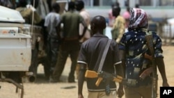
Northern forces are now in control of Abyei following fighting earlier this month. South Sudan President Salva Kiir has said he won’t return to war with the north over Abyei, and added that this was a time for peace. A more than 20 year civil war ended in 2005 with the signing of the Comprehensive Peace Agreement.
While the south will become an independent nation in July, the issue of oil-rich Abyei remains unsettled. A planned referendum on Abyei itself was never held.
Raymond said, “At this point we are continuing to identify forces on both sides of the border. And also, we’re paying very close attention to the extremely disturbing reports of thousands of internally displaced people fleeing their homes in Abyei and the border region.”
While a satellite image is yet to confirm that, the medical aid group, Doctors Without Borders, is reporting a steady flow of people from Abyei to Agok further south.
“I want to be very clear that we are working every day and are going to try to release imagery every day going forward to update responders on the ground and people around the world about what is happening,” he said.
It can take 12 hours or more to analyze a satellite image before releasing it to the public. Weather conditions could affect images. “There is a lack of verifiable information inside Abyei because of security restrictions,” he said.
Why Abyei?
“Abyei is being contextualized in terms of being an oil rich or water rich region. Abyei’s significance is much bigger than that.” he said, “Reports of alleged ethnic cleansing and the movement of nomadic Misseriya people into that area in the past few days are deeply disturbing,” said Raymond.
Raymond added, “Violence in Abyei could mean a return of violence for Sudan.”