To help south Sudan prepare for independence, Internet giant Google is training volunteers to help improve maps of the new country. While the initiative aims to facilitate development in the south, it also could have political implications.
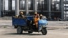
What is a country without a map? On the brink of independence, south Sudan lacks a lot of basic information about its own towns and communities.
Now, a project organized by Google, the World Bank and other organizations is recruiting volunteers with local knowledge of the region to fill in the gaps.
France Lamy, program director for Google.org, explained the system at a "mapping Sudan" conference in Nairobi.
"Map Maker is a web mapping collaborative platform, which combines high resolution imagery while also allowing the communities to map features that they know such as schools, roads, hospitals, using high-resolution imagery as background information," said Lamy. "So this is to map basic infrastructures."
Here’s how it works. Pretty much anybody with Internet access can add information to Google’s satellite map images using Map Maker. They click on a building and identify it as a school. Or click on a stretch of road and write in the name. The information is checked and verified by other volunteers.
In south Sudan in particular, the point is to help improve maps so that the government can identify where services like schools and hospitals are most needed. It also could help non-governmental organizations and aid workers better serve the area.
"What the United Nations indicated, what was important to map, was the main cities, especially in local, rural areas, and also the transportation networks," said Lamy.
Organizers deny that the program could be used for political purposes as northern and southern Sudan battle over the future boundaries of the two countries.
But Charles Mona, who heads the south's mapping office, said the data that the Google project provides could still help the south in the border dispute.
"The data we are having, we are collecting, can show a distinct border between the north and the south, but as I was saying, some people may not accept that fact," said Mona. "So unless that political will is there, it will be not much help."
Some southern Sudanese also remain skeptical about the project.
Bol Agoot is a 25-year old economics student at Nairobi University and a native of Southern Kordofan, one of the disputed areas.
"It should start from south Sudan rather than starting from the Diaspora - we are just a group," said Agoot. "We don't know who is doing what in south Sudan. So we expect this program to be between the government and the Google and the World Bank. But the way it is started, it looks like it is the World Bank and the Google and then later they will invite southern Sudan to join them."
The event in Nairobi was the second mapmaking conference hosted by Google and the World Bank, following a first effort in Washington in April. Organizers hope to hold the next session in south Sudan.
Google Leads Effort to Get South Sudan on Map
- By Gabe Joselow