It’s not precisely clear why a 16th-century German cartographer chose to honor the Italian explorer Amerigo Vespucci by naming a land mass after him instead of Christopher Columbus, who historically gets the credit for America’s discovery.
But Martin Waldseemuller’s 1507 map has been called America’s birth certificate as the first geographic document to apply the moniker.
"Columbus discovered America, Vespucci sold it," said John Hessler, a Library of Congress cartography expert and curator. He added that Vespucci, an active promoter of his New World travels, "did market himself more."
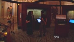
The prized Waldseemuller map takes a prominent place in the library’s precolonial pavilion, as well as in its map catalogue. Its double-glass casing reminds visitors that they are in the presence of "one of the central, cultural documents of geographic history from the early Renaissance period," said Hessler, author of “The Naming of America.”
Mysteries persist
The map raises more questions than it answers. Waldseemuller produced the map only 15 years after Columbus landed on the shores of the new continent, when few European settlements existed and the land mass remained mostly unknown except to its inhabitants.
Yet, a German cartographer from a remote village in the Alsace Mountains provided an outline of the New World that, much to the wonder of scholars and visitors alike, bears a surprising resemblance to the American continent’s eastern coastline.
Perhaps most intriguing is the Pacific Ocean’s presence on the map. When the document was created, the accepted idea was that one body of water stretched from the far eastern shores of Asia to the western coast of Europe.
Hessler calls the map "a living mystery" that will keep baffling scholars for years to come – unless other documents are discovered and explain how the cartographer compiled his information.
Waldseemuller’s own words suggest the map was more than a lucky vision. The cartographer included a small text to reassure his contemporaries about the accuracy of his work, writing: "This is the way you’ll come to see your world in the future. This is the way the world is."
The map changed the thinking of European world, with a reported 1,000 copies – each in 12 sections – printed for distribution, according to the library website.
Bringing the map to America
The only known surviving copy was discovered in 1901 by a Jesuit priest doing research in a castle in Baden-Baden, Germany. Priceless to scholars, it eventually came with a $10 million price tag agreed upon in 2001 by Prince Johannes Waldburg-Wolfegg – whose family had retained that and other maps at their castle – and the Library of Congress. Congress allocated half the amount, with private donors supplying the balance.
At a 2007 ceremony in Washington, German Chancellor Angela Merkel officially turned over the Waldseemuller map to library officials, with the understanding that it would be showcased.
A treasure forgotten for centuries on a castle’s shelves now can be viewed at the library – where it is on permanent display – or on the library’s website.


