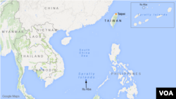
An unsourced map from a random website is insufficient documentation to overrule an international tribunal’s decision over the status of a small land mass in the hotly contested Spratly Islands, a top U.S. State Department official said on Thursday.
That edict came down one day after Hong Kong-based Phoenix TV produced what it called a U.S. government map from 2010 recognizing Taiping, also known as Itu Aba, as an “island" and not a “reef” or “rock.”
The television producers, it appeared, were attempting to challenge Tuesday's United Nations arbitration court ruling on the legal basis for Beijing’s claim to disputed maritime territories in the South China Sea.
Article 121(3) under the Law of the Sea Convention, which informed the tribunal's decision, states that "rocks which cannot sustain human habitation or economic life of their own, under the law’s definition, shall have no exclusive economic zone or continental shelf."
“You know, pulling in a random U.S. map from a website is not going to influence that,” State Department spokesperson Elizabeth Trudeau told a Chinese reporter, explaining that the United States doesn't take a position on whether small islands around the world satisfy technical criteria of Article 121(3).
And even if it did, she implied, it is unlikely the U.S. government would endorse a map found on Singapore National University’s website for its representations of maritime features.
For a land feature to be considered a territory with exclusive rights over surrounding waters, it must remain above water at high tide, the panel ruled earlier this week.
While China has carried out extensive land reclamation on many coral reefs, such improvements do not alter the features' legal status, which is based on their "natural condition" before such constructions, the court said.
This report was produced in collaboration with VOA's Mandarin Service.


