LOS ANGELES —
Aid and reconstruction workers responding to the disaster in the Philippines now have one more tool to help them in their work. A map created by NASA's Jet Propulsion Laboratory shows areas that suffered the most damage from Typhoon Haiyan. Scientists in Southern California created the map, which also is home to the largest Philippine-American community.
At the Cathedral of Our Lady of the Angels, Philippine Americans come to support each other and pray for their loved ones who were hit by the storm. Many Philippine Americans feel helpless and that includes Fe Alvarez Mangila.
“If only I could go directly there to extend our help at once, but it’s quite impossible,” said Mangila.
She wasn't able to go help her sisters recover from the devastation. “Their house was 90 percent destroyed.”
Mangila and many Filipinos can only offer spiritual and financial help, but Susan Owen and her co-workers are using science to help out.
“It was disturbing to see how much of the city was painted in red when we saw this map,” said Owen.
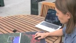
Owen points to a map generated by scientists at NASA’S Jet Propulsion Laboratory. In red, the map shows storm damage in a region near Tacloban where the typhoon made landfall. The map uses data generated by the Italian space agency’s radar satellite to form a composite of images before and after the typhoon.
“So we’re using energy reflected back from the Earth to determine the type of damage that has occurred in this region. You can imagine that buildings that are standing are going to reflect energy back differently than after they’ve been destroyed,” said Owen.
Alanna Simpson, of the Global Facility for Disaster Reduction and Recovery, said her group has a team in the Philippines and is using the map to help with reconstruction. “For us right now we need to know which areas have been most affected."
The map not only helps international relief agencies and people in the Philippines identify damage in remote areas.
“We know from people who have contacted us that they are looking for areas where they can land aircraft. And so, using this map, they can identify areas that aren’t as damaged,” said Owen.
Owen said her team will continue to collect satellite data as needed to see how reconstruction is progressing.
Whether it’s through science, money or prayers, many Philippine Americans say they are thankful for those who are trying to help victims of the storm.


