Most Accurate Projection of Polar Ice Melt Produced to Date
Surface melt water rushes along the surface of the Greenland Ice Sheet through a supra-glacial stream channel. [Image courtesy of Ian Joughin]
Scientists have produced the clearest picture yet of a key indicator of global warming - the world’s shrinking polar ice sheets. The international study ends a 20-year dispute over how much ice is being lost or gained in Greenland and Antarctica.
Measuring ice sheets is a tricky business. Over the last two decades, dozens of studies on ice loss have come up with conflicting results. Now, a global scientific team, reporting in the journal Science, has tried to set the record straight.
Different Assessment Methods Agree
Andrew Shepherd is a professor of Earth sciences at the University of Leeds in England and lead author of the study. He says teams of experts from 25 international institutions, working at the same time and in the same locations, used different methods to gather ice-loss data, and then compared what they found.
“When you look at the data, the ice sheets do have their own weather," he said. "From month to month we can see very different amounts of ice in Antarctica as compared to Greenland for example, and it becomes very important when you are comparing different estimates, that they’re made over the same time period and over the same geographical area.”
Shepherd says the results from the diverse research teams are two to three times more accurate than the most recent report from the Intergovernmental Panel on Climate Change (IPCC), the scientific body set up by the United Nations to regularly assess climate change.
“The total amounts of ice lost from Greenland and on Antarctica all together since 1992, amounts to about 11 millimeters of global sea level rise,” Shepherd said. Of that 11 millimeters, he adds, two-thirds to three-quarters is from Greenland and the remainder is from Antarctica.
All Ice Sheets Losing Mass Except East Antarctica
While 11 millimeters might not seem like much, Shepherd says the combined rate of ice melt has increased over time.
“In the 1990s the ice sheets were losing about 0.3 millimeters of ice in terms of global sea level equivalent each year," he said. "Right now they are losing three times as much.”
The study finds that all ice sheets are losing mass - except for East Antarctica, where climate change is having a different effect.
“In East Antarctica, "Shephard noted, "it’s a very large area and receives a very large amount of snowfall. The signal of growth is consistent with that story.”
New Assessment Critical to Climate Modeling
Co-author Ian Joughin, a glaciologist at the University of Washington, says the information they’ve gathered for the study is critical to modeling global climate and predicting sea level rise. He says even tiny changes in sea level, when added over an entire ocean, can have a substantial impact on storm surge and flooding forecasts for coastal and island communities.
“It’s important to keep in mind," Joughin says, "that this is a snapshot of the current mass balance of the last two decades’ mass balance of the ice sheets.” The expected warming, he predicts, will accelerate losses going further into the rest of the century.
Lead author Andrew Shepherd says he hopes the international teams will continue their ice-sheet surveys each year, and fill in some of the gaps left by less-frequent IPCC climate assessments.
“We hope that this is an annual exercise where every team that has contributed to this assessment can do this on a more regular time than the IPCC reports, which are very useful assessments on a five- or six-year cycle, but in the intervening five or six years, it leaves people in the dark as to how things have changed,” he said.
The new ice-sheet data, reported in the journal Science, comes amid a flurry of new climate-change reports published in recent days, while international delegates in Doha, Qatar, discuss a new U.N. climate change treaty. Those talks conclude on December 7.
Polar Melt
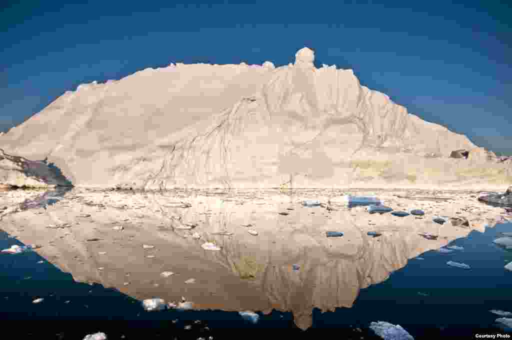
1/15The midnight sun casts a golden glow on an iceberg and its reflection in Disko Bay, Greenland. Much of Greenland’s annual mass loss occurs through calving of icebergs such as this. (Photo courtesy Ian Joughin)
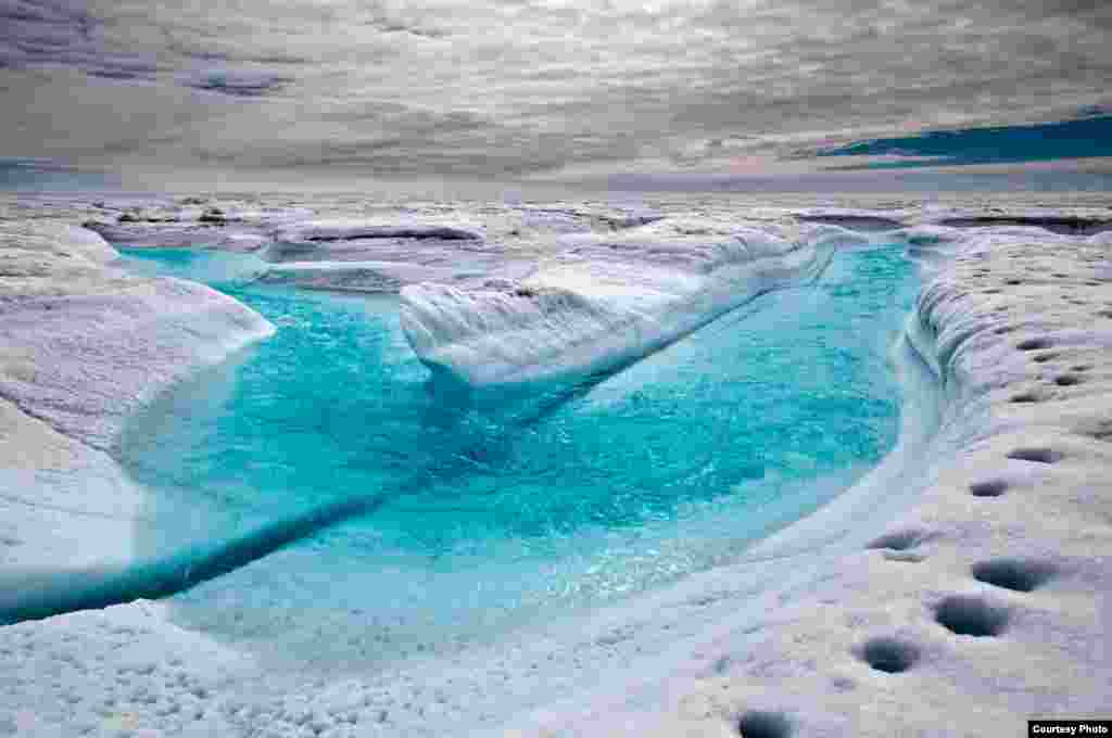
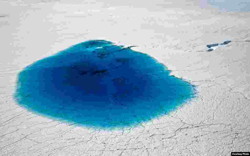
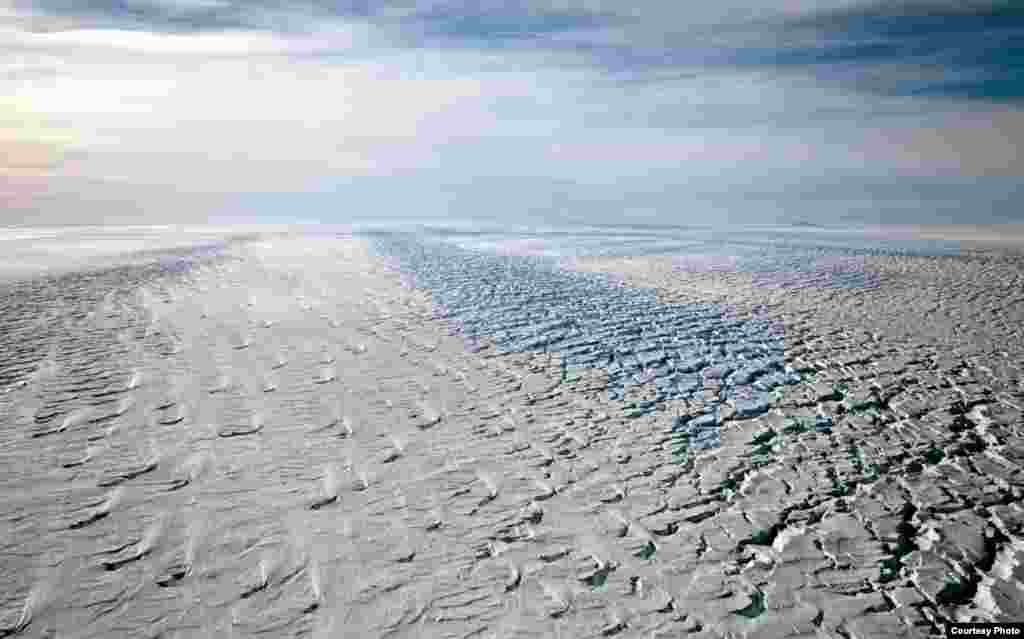
2/15Each summer, streams channel much of the melt that is produced by the warmer temperatures along the Greenland Ice Sheet’s lower elevation margins. (Photo courtesy Ian Joughin)
3/15Surface melt water rushes along the surface of the Greenland Ice Sheet through a supra-glacial stream channel. (Photo courtesy Ian Joughin)
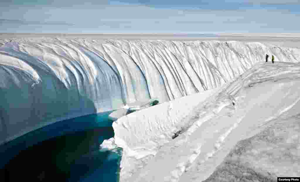
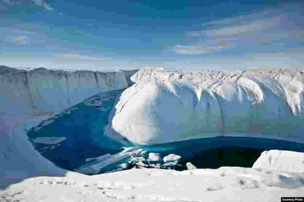
4/15Over the course of several years, turbulent water overflow from a large melt lake carved this 60-foot deep canyon. Note the people for scale. (Photo courtesy of Ian Joughin)
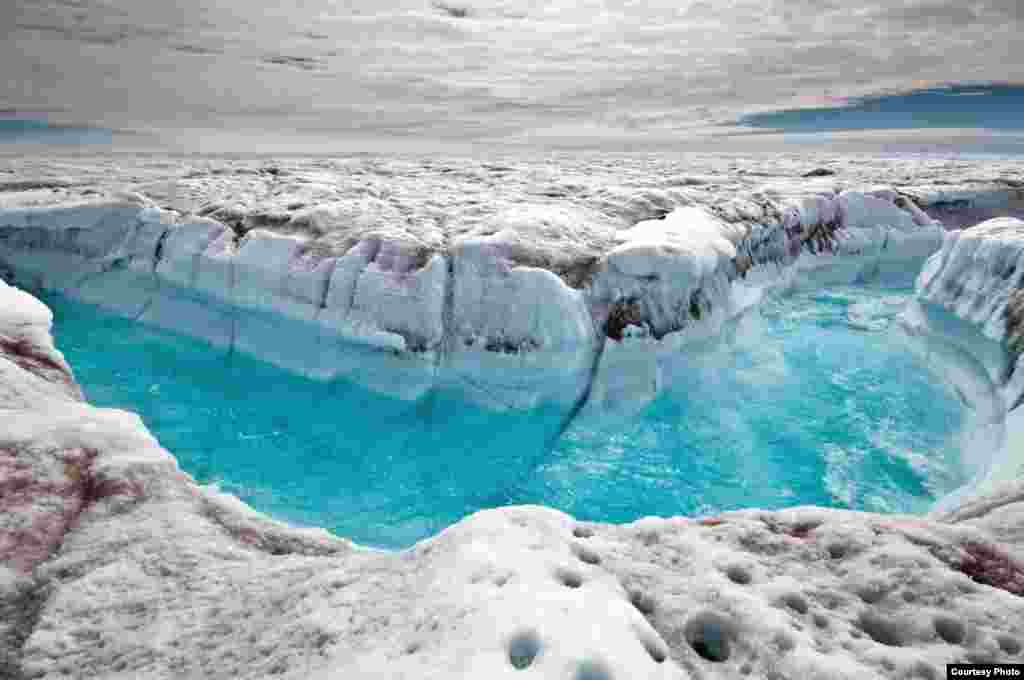
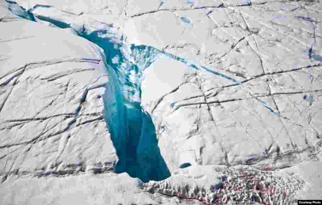
5/15For several summers this deeply incised melt channel transported overflow from a large melt lake to a Moulin, a conduit that drains the water through many hundreds of feet to the ice sheet’s bed. (Photo courtesy Ian Joughin)
6/15香港刘霞关注组为刘霞举行庆生会(美国之音海彦拍摄)
7/15Moulin that drains surface meltwater through ice more than 3000 feet thick to reach base of the ice sheet, from where a subglacial drainage network ultimately routes it to the ocean. (Photo courtesy Ian Joughin)
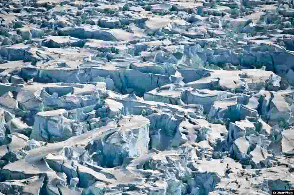
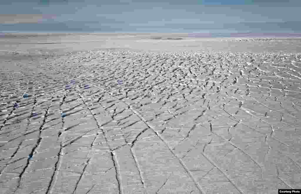
8/15Close-up of large crevasses produced by Pine Island Glacier’s rapidly stretching ice just above its grounding line (the transition from grounded to floating ice). (Photo courtesy of Ian Joughin)
9/15Close-up of large crevasses produced by Pine Island Glacier’s rapidly stretching ice just above its grounding line (the transition from grounded to floating ice). (Photo courtesy Ian Joughin)
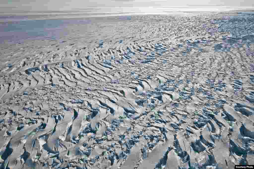
10/15Curvi-linear crevasses in a region of complex ice flow on Pine Island Glacier, West Antarctica. (Photo courtesy Ian Joughin)
11/15Koji Kubota of the Japan Coast Guard keeps watch while flying in the search zone for debris from flight MH370, April 1, 2014.
12/15People pass by barricades near the Dnipro Hotel in Kyiv, April 1, 2014.
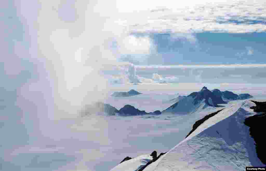
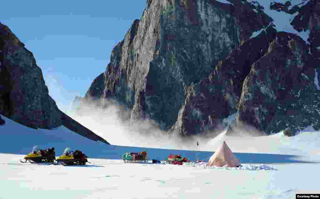
13/15A British Antarctic Survey two-man field camp next to The Obelisk on Alexander Island, Antarctic Peninsula. (Image courtesy of Hamish Pritchard, British Antarctic Survey)
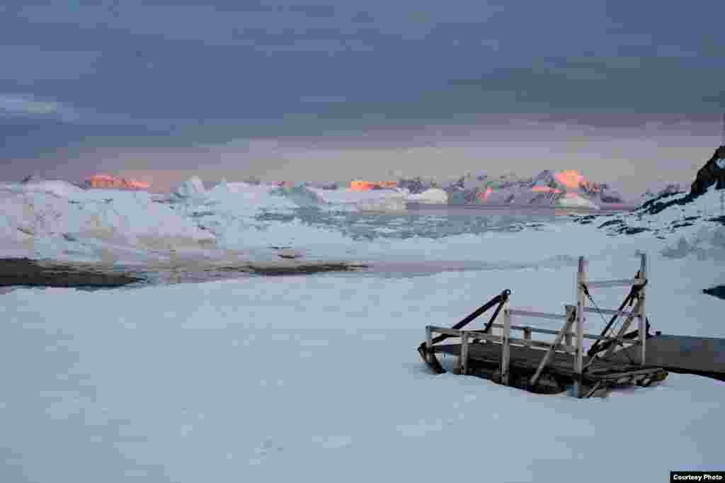
14/15The late summer sun sets over mountains and icebergs around Adelaide Island, Antarctic Peninsula, as twenty-four hour daylight gives way to the long polar night of winter. (Image courtesy of Hamish Pritchard, British Antarctic Survey)
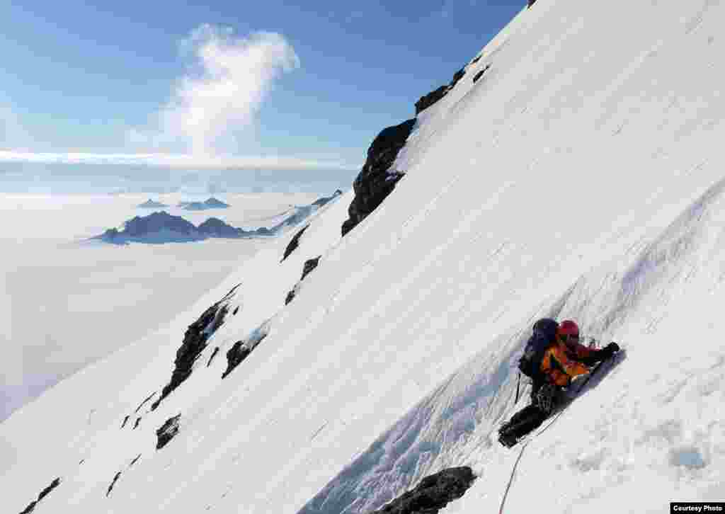
15/15Hamish Pritchard on a British Antarctic Survey expedition in the Herschel Heights, Alexander Island. Rock samples can tell us when these summits emerged from the retreating ice sheet. (Photo courtesy of Mike Brian)
![Surface melt water rushes along the surface of the Greenland Ice Sheet through a supra-glacial stream channel. [Image courtesy of Ian Joughin]](https://gdb.voanews.com/5b2f2c65-7421-4348-9df7-a77feb681a95_w250_r1_s.jpg)