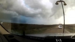
A team of scientists in Boulder, Colorado, is working to improve forecasts by studying how monster storms form up close.
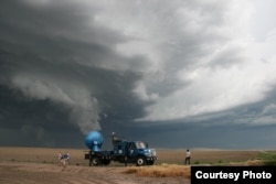
Doppler radar reads the weather based on reflections from items moving through the air. Joshua Wurman was the first to put the technology on wheels and drive it directly into the path of a tornado.
“I invented Doppler on Wheels in the 1990s because I was frustrated that I couldn’t see enough detail inside tornados and hurricanes," Wurman said. "We had blurry images of all these things and in order to really understand the physics, the math of what is going on inside a tornado, how exactly are they forming, how strong are the winds right at the surface are, we need to get up very, very, close."
Storm Chaser
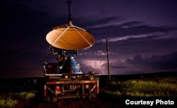
Wurman, who directs the Center for Severe Weather Research, deploys Doppler on Wheels to chase storms. His fleet consists of large panel trucks with rotating antenna dishes mounted on the back.
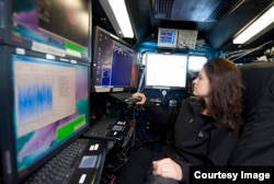
Those high-powered antennas send out radio waves that reflect objects in the air from raindrops to birds. Wurman and his team watch the weather patterns in real time from inside the truck.
“I’m seeing it through computers and through the radar screens, which are making three dimensional images of the wind and the debris and the hail, flowing around the storm,” Wurman said.
Weather forecasts, based on data from satellites, fixed radar networks and computer models, help guide the trucks to the precise location of a storm that could spawn a tornado. Doppler on Wheels has driven into more than 200 tornados so far.
“When we get up close to a storm while it’s in the process of making a tornado, we can look at the evolution of the winds near the surface, how that relates to the winds aloft, how the precipitation, the rain and the hail, influences whether the air is going up or down, whether it’s cold or warm, and how that is causing or not causing a tornado to form,” Wurman said.
Lifecycle of tornados
The analysis combines the Doppler images and 3D maps with data from steel weather pods, large heavy metal discs with measuring instruments. The pods are placed in the path of a storm to collect data from the ground, below the range of the radar.
“That’s where we live. We live right near the ground," Wurman said. "Buildings are built right on the ground and we need to understand more about how the winds do damage, how the debris field interacts with the winds and does damage.”
That data could lead to better building design in storm prone areas.
As they observe the life cycle of tornados, scientists are getting a better understanding of which storms develop into tornados and which die away. One factor revealed by the radar is a secondary wind surge that Wurman says could trigger the tornado.
“The scientific process is that we need to now observe that and repeat that observation in maybe a dozen or more other thunderstorms, and in maybe a dozen or more thunderstorms that aren’t making tornados, to really see if that surge causes tornados and if there is no surge, whether there is no tornado,” he said.
Mobile scientific laboratory
Doppler on Wheels is an advanced mobile scientific laboratory. Along with hundreds of twisters, it has also chased several hurricanes, expanding what we know about those storms.
Positioned on the Louisiana coast for Hurricane Gustav in 2008, the fleet captured high resolution measurements as the hurricane came ashore. The images show winds in surprising corkscrew rolls.
“And that corkscrewing motion does two things," Wurman said. "One, it brings strong winds down to the surface and those stronger winds have a much greater potential to cause damage. But in addition, on the way back up, those winds are carrying heat and moisture from the ocean, which is basically the food, the fuel for a hurricane.”
For tornados, the false alarm forecast rate has hovered around 75 percent for decades. Looking at those winds could give forecasters a better idea of the intensity of the storm, which could translate into more accurate forecasts. And that, Wurman says, can save lives.


