MANILA —
Philippine disaster risk reduction planners are mapping their way through the hazard-prone parts of metropolitan Manila with a tool that will help pinpoint vulnerable structures, assess population density and calculate financial losses should disaster strike. Planners are looking to use it nationwide.
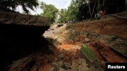
The Philippines is one of the most disaster-prone countries in the world. Its location in the Pacific places it on tectonic plates, making it vulnerable to earthquakes, as well as tropical cyclones and heavy rain.
Over the years, various geo-hazard maps have been issued showing fault lines and flood zones - areas where disasters could happen. But the maps the national government recently gave officials of the 16 municipalities in Metro Manila indicate the effects of ground-shaking from earthquakes, wind damage from cyclones and flooding from heavy rain.
The scenarios were simulated with LiDAR, a remote sensing technology that illuminates an object [like a building] with lasers and analyzes the light it reflects.
Risk analysis
Geologist Renato Solidum heads the Philippine Institute of Volcanology and Seismology and his office did the risk analysis of earthquake scenarios. He said these new maps help planners foster their “disaster imagination.”
“Sometimes in order to convince decision-makers and even people to do things right away is, you have to show: How many people will die, how many buildings will suffer, how many millions of pesos would you need to rehabilitate or replace this? You need damage or impact figures, rather than the threat.”
In the risk analysis project, one earthquake scenario shows a 7.2 magnitude quake in the metro area would result in 37,000 dead and would cost $56 million, with varying degrees of damage to floor area.
The country is not only naturally disaster prone, its urban centers are beset with multiple factors that increase exposure to risk. These include rapid growth, non-compliance with zoning and building codes, squatters in flood-prone areas and poor solid waste management.
'Exposure database'
Researchers on the project created what they call an “exposure database.” It combines population and structural information, such as a building’s age and where development has spread, to pinpoint at-risk areas. In exchange for getting the software and training on how to use it, city planners have to update the database with details from their localities and share it with national government.
But Ishmael Narag, a researcher also at the Institute, said being prepared when disasters happen does not have to depend on the technology. He said smaller, poorer municipalities can still take action.
“Even if they don’t have the sophisticated LiDAR data, they can probably do, say, a Level C assessment of the risk, using the available data from the assessor’s office, the census data and other surveys that are being done within the municipality. Basically it provides a framework for them to come up with a risk-assessment of their own,” said Narag.
Herbert Bautista, Quezon City Mayor and president of the League of Cities of the Philippines, calls the new maps and database a “big deal for local government.” At the turnover of the maps to Metro Manila’s municipalities on Thursday, he said this new tool would help local governments comply with a national law that requires land-use plans to include risk areas.
“The data can help government stop developers from trying to put up subdivisions on fault lines or soil that easily takes in water,” he said.
Risk planning
Narag said getting input from cities will be crucial to the success of using the new tool for disaster risk reduction planning.
“The science is only as good as what the data could give, so it’s very important that this is communicated to the local government. If you provide us with data with a very large uncertainty, the results will have very large uncertainties. So, it’s very important to lessen that uncertainty by opening up their databases,” he said.
The risk analysis project that led to the creation of the maps and the database was a collaboration of the Australian and Philippine governments. Australia Agency for International Development funded it with $5.4 million.